Recently, legislative redistricting enthusiast Cully Williams shared on Twitter every South Dakota legislative district map since statehood in 1889. Maps can be easily found online only since 1991; a couple of prior maps can be found printed in old Legislative Manuals (or “Bluebooks”).
In what must have been a major undertaking, Williams reconstructed every legislative district map from the Session Laws – that is, the text descriptions of each district that are passed into law by the Legislature. Williams also used the Newberry Library’s Atlas of Historical County Boundaries, which is necessary because South Dakota’s county lines changed frequently in the state’s early days. (I have used this resource as well to create county-by-county gubernatorial election maps.) Williams posted these maps in a lengthy string of tweets – you can check it out if you’d like to read his comments on each map.
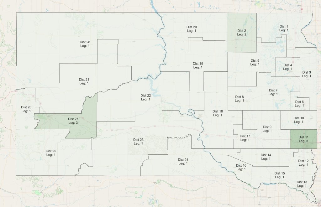
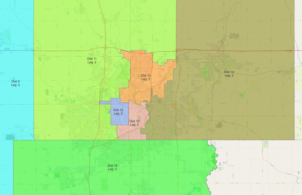
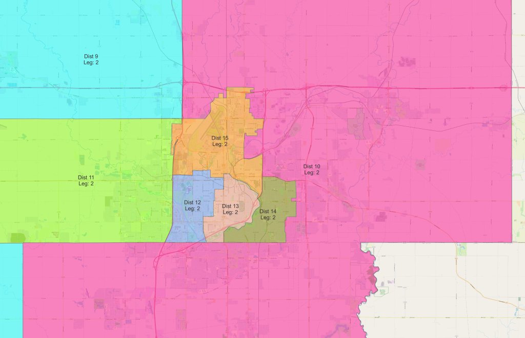
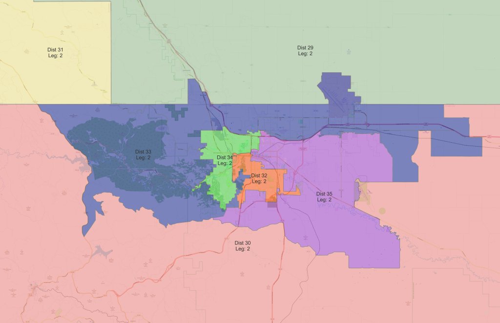
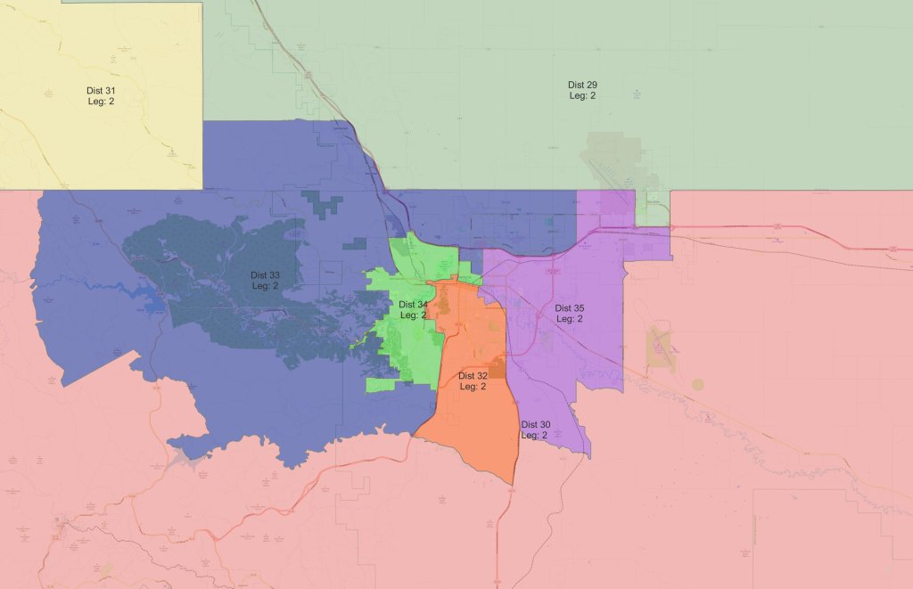
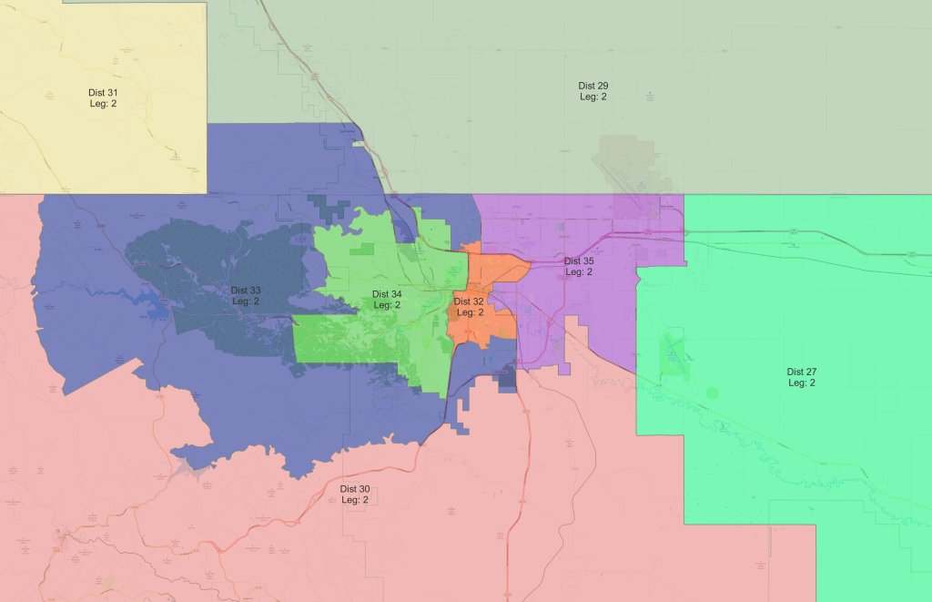
With Williams’ permission, I have posted each statewide map below, as well as zoomed in maps of the Sioux Falls, Rapid City, and Aberdeen areas once those districts became very small in the 1980s. (He included a few more maps that elaborate particular points he makes in his commentary; I didn’t include those as they wouldn’t make much sense without his comments, but they are available in his string.)
The maps are for the most part self-explanatory, but I would offer a couple notes of clarification:
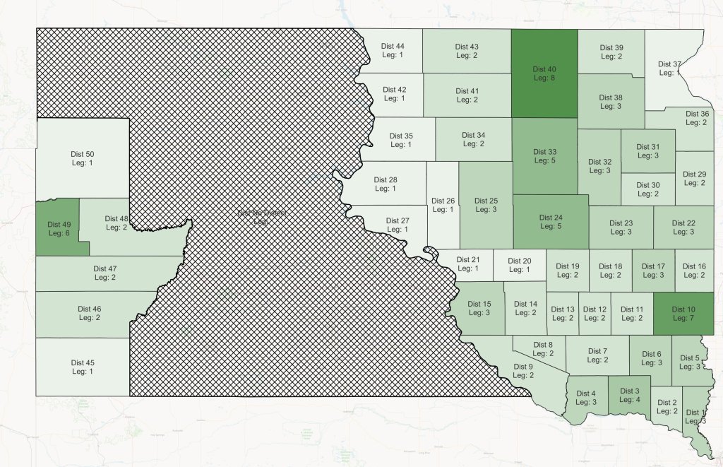
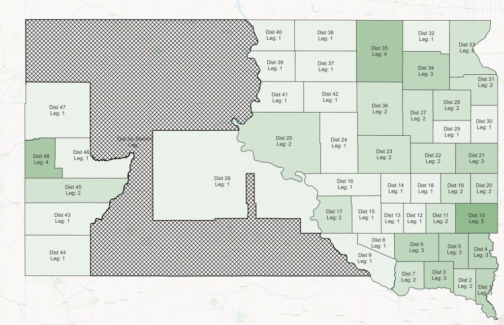
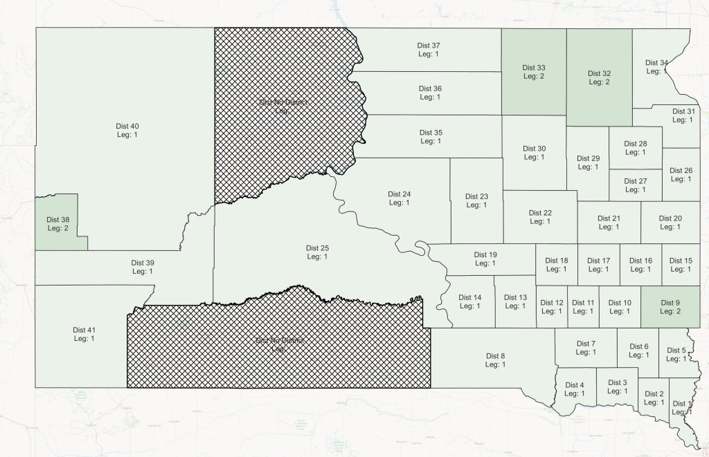
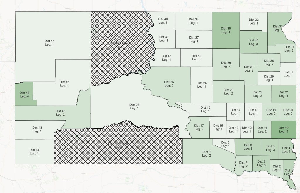
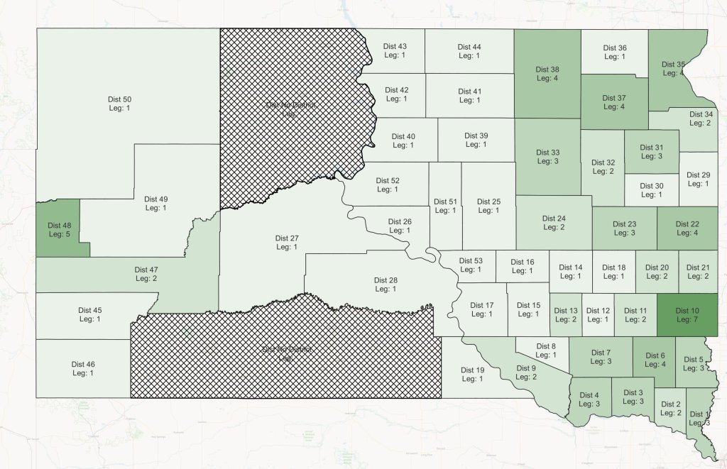
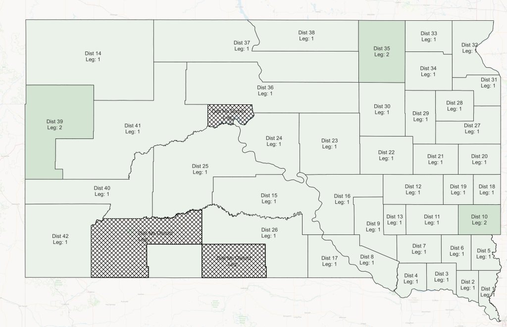
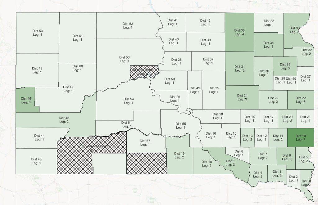
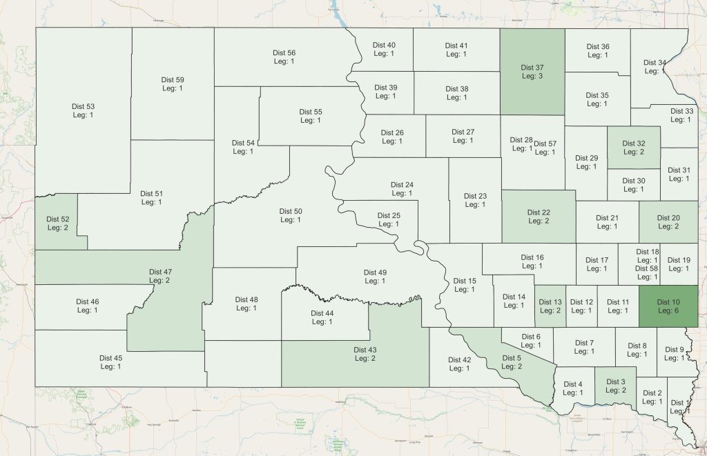
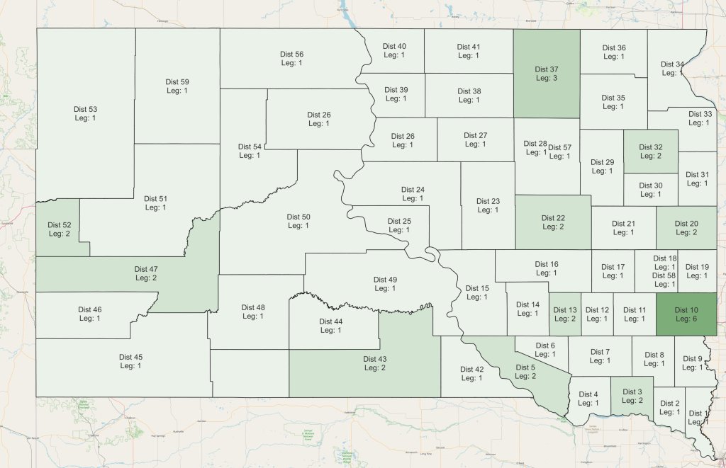
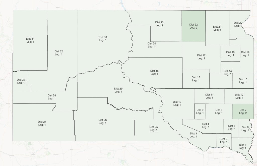
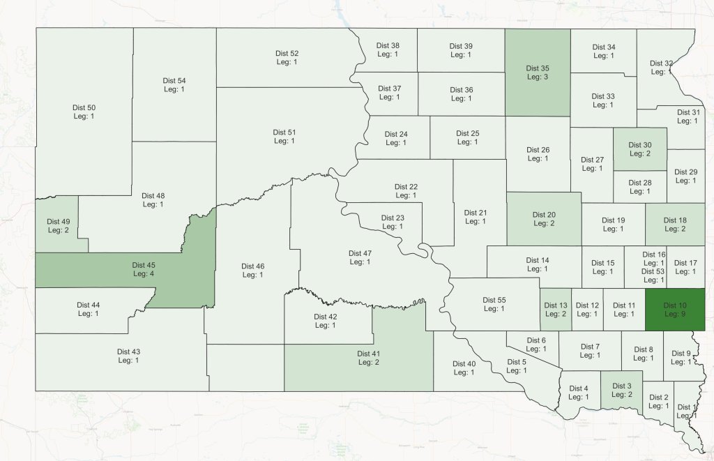
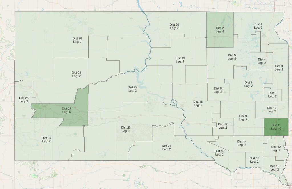
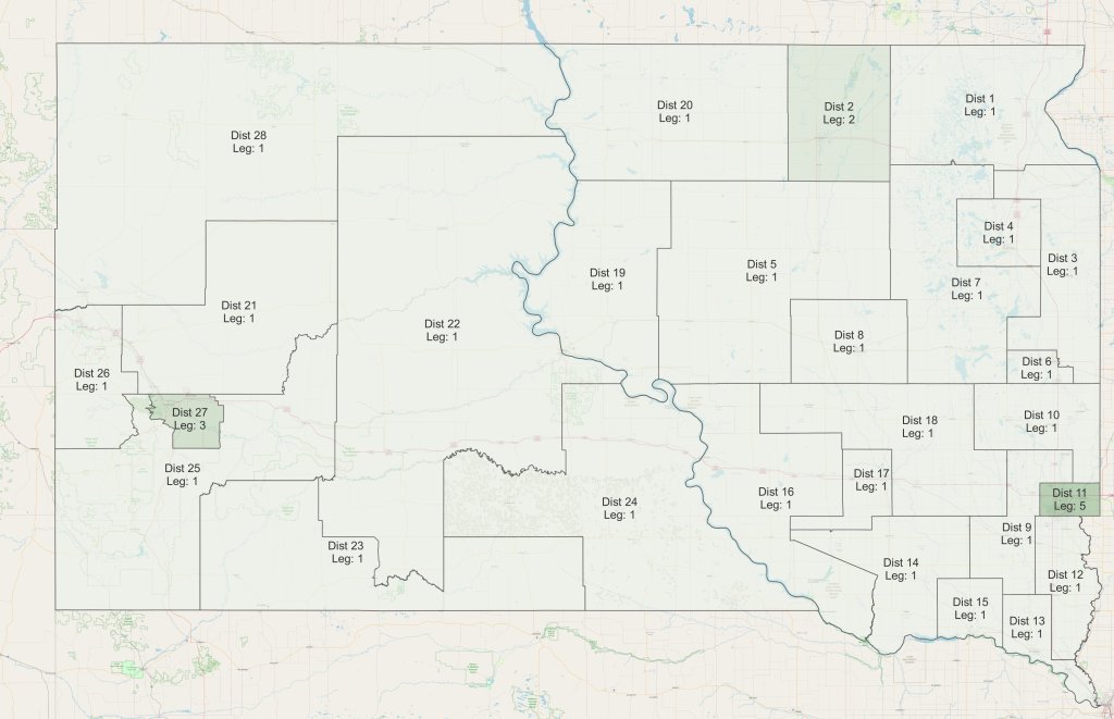
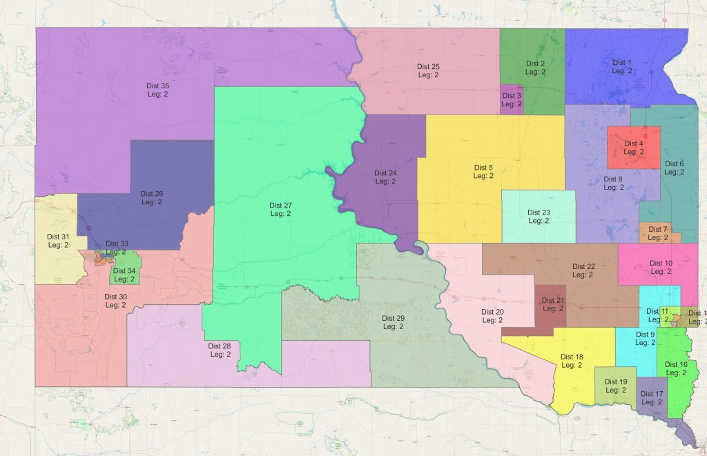
- For each map, the year listed is the year that the map was adopted; so, for example, the 2001 map was adopted in 2001, and therefore was first used in 2002 elections for terms beginning in 2003. (Williams’ maps do not have year on the image, so I have captioned each map immediately below it.)
- The U.S. Census is conducted every ten years, in years ending in a zero. Until the 1950s, the State did its own census as well, in years ending with a five, and in some cases the Legislature redistricted after both federal and state censuses. (Having said that, in early years redistricting doesn’t always follow a predictable pattern. Williams didn’t attempt to explain that; he simply searched the session laws for redistricting acts and took them as he found them. I have also not researched this and can offer no explanation.)
- There are a few instances on House maps from 1911-1961 in which one county is covered in the statue by two districts. In these cases, Williams has centered the label in the district described by the statute. (Examples are Hamlin and Deuel counties form 1911-33, Perkins and Meade from 1917-33, and Lake and Moody from 1937-61).
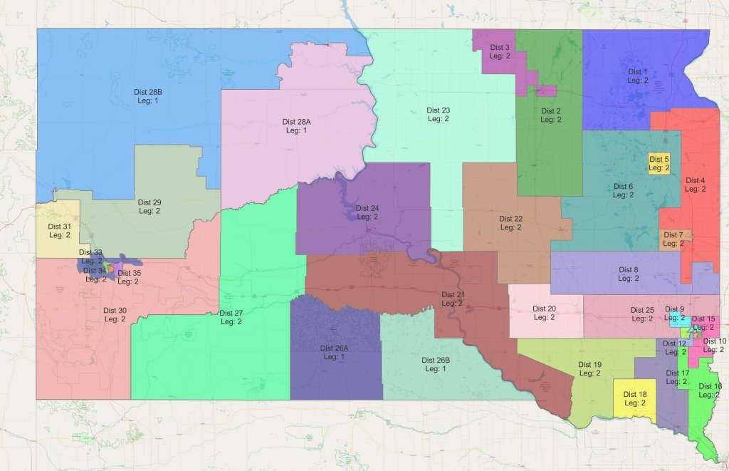
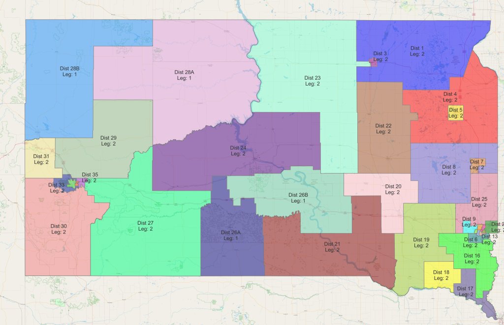
- From 1889-1961, there were separate Senate and House maps. The maps were often similar but not identical, and Williams notes on his map how many seats each district received. Beginning in 1971, Senate and House districts are the same; each district elects one senator and two representatives at-large (except in rare cases where the district is divided into two single-member House districts to increase Native American representation; in those cases, the House districts are numbered, for example, “28A” and “28B”, and they elect a senator jointly).
- Reforms during the 1960s, such as the U.S. Supreme Court ruling Baker v. Carr and the Voting Rights Act, created strict “one man, one vote” requirements that are in force to this day. The consequence is that legislative districts can no longer strictly honor county boundaries, and instead have to be drawn more finely to achieve near-equal population. That can first be seen in the 1971 maps.
- Prior to 1983, larger counties elected their legislators at-large. For example, on the 1981 Senate map, Minnehaha County received 5 senators – voters would have voted for any five candidates from the among those candidates running. Beginning in 1983, multi-member senate districts were abolished and these more populated areas were divided into smaller single-member districts. That’s why there is a 1981 map and a 1983 map.
- Some early maps include grayed areas that are not part of any district. In the early days of statehood, Native Americans were not U.S. citizens and could not vote (this changed in the 1920s), so if no white settlers inhabited an area, it had no voters and therefore was not included in a legislative district.
- A federal court ruling required the 2001 map to be modified to increase Native American representation; that is why there is a revised map in 2005.
- For the maps since 1983, a layer of highways and other features is visible beneath the districts. That layer is a current, 2022 map, not a map from the time. That’s particularly important when viewing the Sioux Falls and Rapid City area maps.
Finally, Williams told me that he is “really hesitant” about aspects of his 1983 map, because he has not been able to find a map of census enumeration districts, which he needs to reconstruct districts in Bennett, Brown, Minnehaha, and Pennington counties. He did the best he could from hand-drawn maps in newspapers, but asked that if anyone has those census enumeration districts, he would like to have them so he can re-render the 1983 map.
Cully Williams and I have different political perspectives, but we share an interest in South Dakota political history. I appreciate the considerable work he put into creating this great resource, and his willingness to allow me to post them here so they are more easily accessible.